‘Miserable’ fog likely to persist
Staff Reporter
19 June 2023, 12:33 AM
 Roving reporter Scout checks the fog level. PHOTO: Wānaka App
 The Met Service says the “miserable” inversion layer is likely to persist until at least the coming weekend, in the absence of a front to “flush it out”.
The inversion is an annual weather event which results from rapid cooling at the surface under clear sky conditions, forming an inversion at low levels due to the temperature difference of the air just above the surface of the land and the air higher up.
Meteorologist Andrew James said it’s currently “very miserable” in Alexandra, which reached a high of three degrees on Sunday (June 18).
“Not great, not particularly warm and typical for this time of the year to get a long spell of this kind of weather.
“We are seeing signs of that continuing through to Saturday. We need to get rid of this - get something to come through and flush it out.”

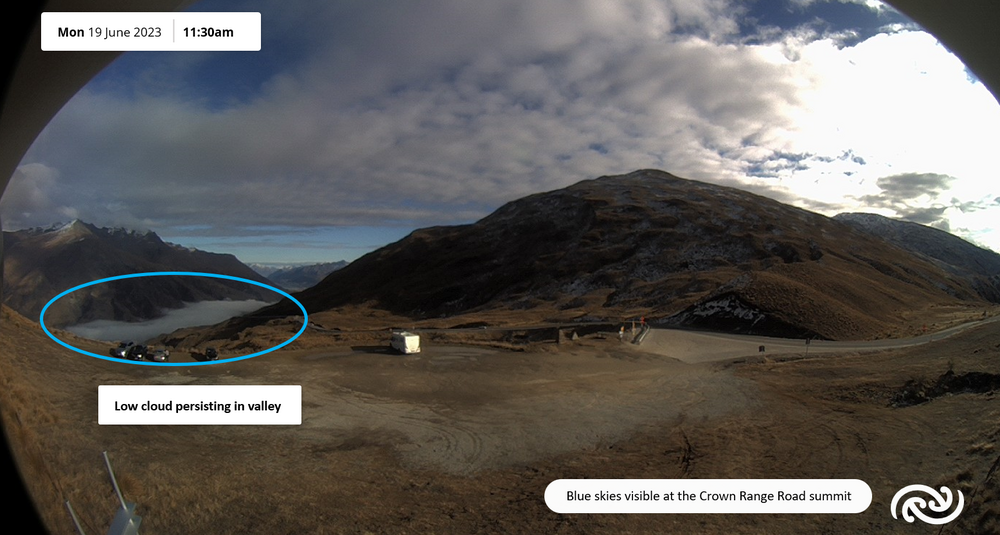
This image from the Crown Range webcam highlights the inversion cloud. IMAGE: NZ Met Service
Unfortunately he wasn’t seeing much change, although he said it “may break up a little bit through the weekend”.
“For now it’s looking like another few chilly days and cloudy conditions persisting in those sheltered valleys.”
The Met Service says the lack of heating at this time of the year, when the sun’s at its weakest, combined with a lack of wind to mix dry air from above, means the moisture stays in basins and valleys.
Usually under a ridge of high pressure there are light winds and generally clear skies, which allows rapid cooling to take place at the surface but if there’s moisture trapped at low levels that condenses into fog, which can stay trapped in these valleys for days.
People’s best bet to find some sun is to walk up a hill or head to skifields Cardrona Alpine Resort (now open) or Treble Cone which is scheduled to open this weekend (Saturday June 24).
Keep an eye on the Ski report on The Central App click here Skiing


