Metservice warns of strong winds and rain today
19 October 2025, 5:34 PM
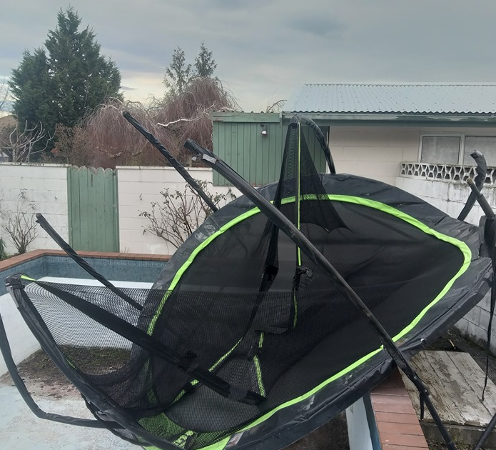 Locals are urged to secure outdoor items. Photo: File
A severe weather warning has been issued by MetService for the Otago headwaters, with heavy rain and strong winds expected throughout today (Monday October 20).
MetService is warning residents and visitors to prepare for potentially hazardous conditions as a strong and humid northwest flow pushes a front across the region.
Between 7:00am and 9:00pm today, up to 160mm of rain is expected near the main divide, and between 80mm and 120mm within 30km east of it. Severe gale northwesterly is expected, gusting 120 km/h in exposed places.
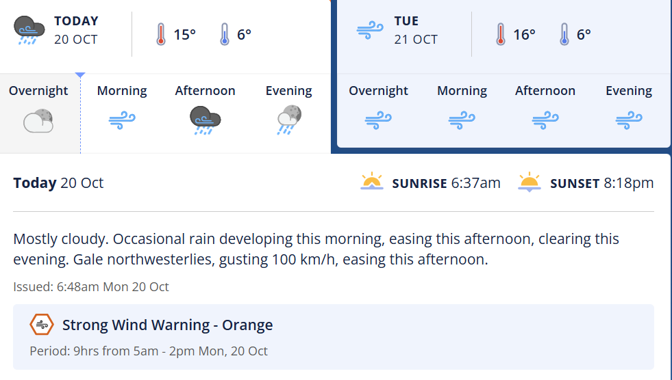
Peak rainfall rates may reach 20mm per hour in some areas, and while the snow level remains around 2200 metres, the downpour could affect river systems well beyond the divide.
MetService said streams and rivers could rise, leading to slips, surface flooding and difficult driving conditions.
Locals are being urged to:
- Secure loose outdoor items like trampolines, furniture, and bins
- Clear gutters and drains to reduce the risk of surface flooding
- Avoid driving through flood-prone areas, especially near rivers and low-lying roads
- Drive cautiously. Driving may be difficult, especially for high-sided vehicles and motorcycles
- Be aware of possible damage to trees, powerlines, and unsecured structures
At this stage, there is minimal risk of the alert being upgraded to a Red Warning, but authorities are advising people to stay up to date with the latest forecasts. Note, another period of severe gales possible during Tuesday.
Stay informed via MetService updates and The Central App’s Weather and Roads reports.