First images of Bendigo mine released to public

Kim Bowden
19 September 2025, 12:30 AM
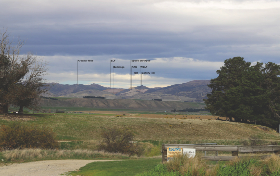 A visual simulation of the view from State Highway 6 of the proposed Bendigo-Ophir mine during its operation phase. Image: Santana Minerals/Boffa Miskel report
For the first time, Central Otago residents are getting a glimpse of what the proposed Bendigo-Ophir gold mine could mean for the landscape.
Santana Minerals today (Friday September 19) released 34 pages of visual simulations showing the site before development, at full scale during operations, and once reshaped after closure.
“These are not glossy marketing images,” Santana chief executive Damian Spring said.
“They are deliberately conservative, worst-case simulations that prioritise accuracy over aesthetics.”
The simulations are created from various vantage points including State Highways 6, 8 and 8A, Queensberry, Pisa Moorings, and Maori Point Road.
The company says the models use 3D computer mapping of the mine footprint, baseline photography designed to replicate human vision, and overlays showing the most exposed public vantage points.
The images, prepared by Boffa Miskell, are expected to draw strong local scrutiny, with the community divided over how much change is acceptable on the hillsides - home to vineyards and conservation areas.
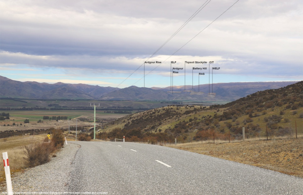
A visual simulation of the view from Queensberry of the proposed Bendigo-Ophir mine during its operation phase. Image: Santana Minerals/Boffa Miskel report
What the public will see in the images includes the existing Rise and Shine and Shepherds Creek valleys prior to mining; the operation phase, with visible pits, haul roads, and processing areas; and post-closure landforms reshaped into the contours of the Dunstan Mountains.
The simulations do not attempt to show replanting or ecological restoration, which the company thinks will soften the visual footprint over time.
“This means the images are somewhat less than expected in reality,” Damian said.
“The real landscape over time will include replanting and natural regeneration that will soften and green the visual footprint.”
The release comes as the company prepares its application under the government’s new Fast-Track Approvals Act.
Damian said the aim was transparency: “We know the community wants clarity on how this project will look, not just what it will deliver economically.”
The release of the simulations follows a packed public meeting in Cromwell several weeks ago, where residents questioned earlier assurances about the mine’s visibility.
The mine chief executive had reportedly compared the effect of the mine on the landscape as viewed from across Lake Dunstan to “a chip in your windscreen”, a remark challenged at the meeting.
Visuals shown then drew audible gasps, with speakers warning the scale of earthworks would reshape the district’s natural backdrop.
Local vineyard owner Rob van der Mark, speaking for Sustainable Tarras, said the mine threatened to change Central Otago’s image from “100 percent pure” to “100 percent industrial gold mining”.
The visuals can be viewed on Santana’s website.
Read more: Anti-mining meeting draws strong turnout in Cromwell
Have a story to share or comment to make? Contact [email protected]
NEWS


JOBS


SHOP ONLINE WITH LOCALS


