The week’s weather

Rowan Schindler
08 June 2021, 12:50 AM
 Central Otago will experience a ridge of high pressure this week which will mimic that last week of weather, according to MetService. Image: Joy Bennett.
 It’s a case of “much of the same” as cloud and still weather will dominate the forecast this week according to MetService.
Cromwell-raised MetService meteorologist Lewis Ferris says the ridge of high pressure sits over the South Island through the working week.
“That means a week where each day resembles the one before,” he says.
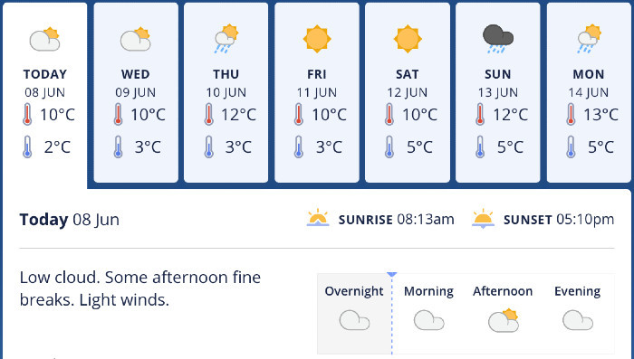
Central Otago will feature mostly cloudy and still days this week, with the odd shower and chilly temperatures. Image: MetService.
Lewis says the persistent cloudy weather is typical of the early period of winter.
“Being this close to the shortest day the sun angle is so low that it’s possible the cloud in the valleys will persist all day,” he says.
“Even with the cloud cover, frosts are possible each morning and icy roads could be present into the afternoon.”
Lewis says temperatures will stay quite low as the cloud hangs around, with showers expected but uncertainty over how much precipitation will make its way to Central.
“Afternoon temperatures will struggle to make double digits, especially if the skies remain cloudy,” he says.
“The settled conditions are forecast to break down on Sunday but there’s plenty of uncertainty about just how much rain will make it into Central Otago.”


