The week’s weather

Rowan Schindler
16 May 2021, 11:32 PM
 MetService says there’s more wintry weather inbound, so pop the chains in the car.
 Colder weather is on its way for Central Otago, with temperatures forecast below zero and into negatives across the district.
Cromwell-raised MetService meteorologist Lewis Ferris says the wintry weather is inbound, so make sure to keep the snow chains in the car just in case.
“This calm and cool Monday morning is set to be disrupted by the arrival of a cold front tonight (Monday night),” he says.
“This cold front brings a period of rain and lowers the freezing level considerably which brings about the risk of snow down to around the 200-300m mark early on Tuesday.
“A Heavy Snow Watch is in force for an area south of Alexandra above 300m between 2am and 6pm and high level roads are likely to be affected throughout Tuesday.”
A cold front is expected to move across the South Island from the southwest this afternoon and evening, followed by cold and showery southwesterlies, bringing significant snow to low levels in the south of the South Island overnight tonight and on Tuesday.
MetService warns this is a significant cold outbreak, and a Heavy Snow Warning is now in force for Fiordland, and Heavy Snow Watches are in force for inland Southland, Clutha and Central Otago south of about Roxburgh.
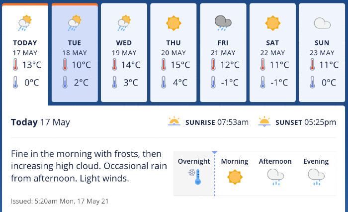
Central Otago will have a wintry blast this week, with snow possibly down to 200-300m early Tuesday morning. Source: MetService.
Mid-week, the weather will hang around as rain and sleet passes through the district.
“A few showers tend to linger around the region on Wednesday but things fine up by Thursday although northwest winds look to be pretty breezy for elevated areas by the end of the day.
“Another front passes by on Friday bringing another period of wet weather but not another low snow event.”
Lewis says the weekend is forecasted to be mostly fine, with Sunday to feature the odd scattered shower.
“At this point Saturday is looking like a fine day and Sunday appears to have a wee southerly flick pass through the region but it doesn’t look overly wet.”
Snow is expected to impact alpine passes, including the Haast, Lindis, and Crown Range from 8pm Monday night through until 10am Tuesday morning.

