ORC responds to Manuherekia criticism

Rowan Schindler
01 June 2021, 5:43 PM
 The Otago Regional Council (ORC) has responded to criticism levelled at it from irrigators in regards to the Manuherekia River minimum flows scenarios.
 The Otago Regional Council (ORC) has attempted to address criticism aimed at their minimum flows report of the Manuherekia River and defended its science-backed decision making process.
Irrigators, including farmers, horticulturists, orchardists and viticulturists have taken exception to the minimum flows scenarios and say they don’t take into account the people or businesses which rely on the river water.
Strategy, Policy and Science General Manager Gwyneth Elsum says “ORC has a role as an environmental regulator for Otago with obligations to carry out its functions under the Resource Management Act”.
“Under the National Policy Statement on Freshwater Management 2020, we are required to set rules and policies that prioritise according to Te Mana o te Wai.
“We must also set minimum flows and water takes (water allocations) for rivers across Otago.”
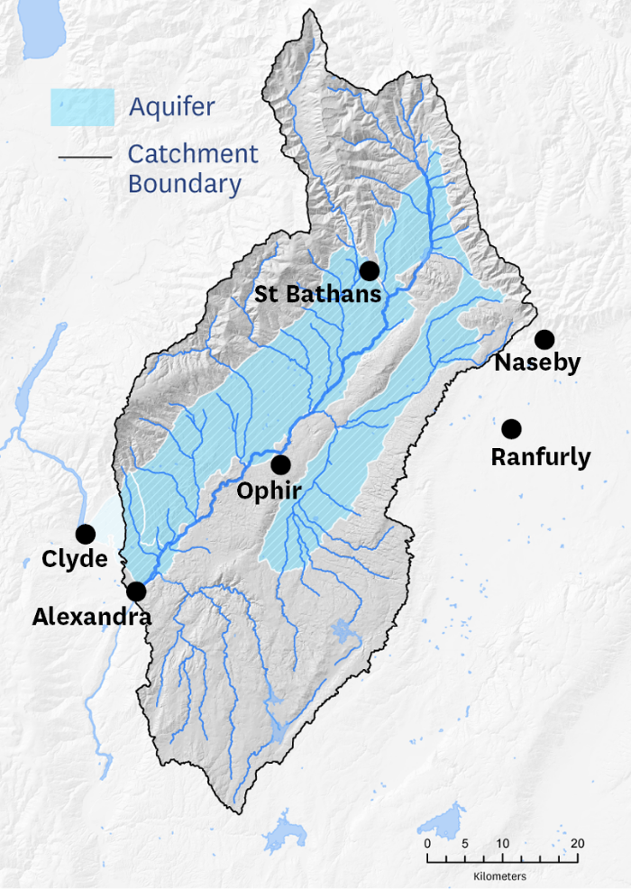
The Manuherekia River catchment area. Source: ORC.
“The five water management scenarios of minimum flows at the Campground monitoring site that have been put forward for feedback were arrived at through a long process of extensive data collection, analysis, community consultation, and discussion with the independent Manuherekia Reference Group,” Gwyneth says.
“The scenarios are backed by a considerable body of technical work, all of which is available to see on our website.
“This work covers hydrology, ecology, economics, and climate change, and we would encourage people to engage with it on its merits.
“Using the considerable technical modelling undertaken we can understand the environmental conditions of the Manuherekia River along its length based on the minimum flow selected at Campground.
“As requested at our community consultation sessions last week, we have now put photos taken at the Little Valley Road Bridge (near the Campground monitoring site) of the Manuherekia River at a range of flows to allow members of the community to better visualise the five water management scenarios.
“We encourage people to share their feedback on the scenarios.
“This will be used by Councillors when they make decisions over the development of our new Land and Water Regional Plan, which is scheduled for notification in 2023.”
You can view the Manuherekia river flow scenarios here. Cutoff for public submissions is June 8.

