Cold snap expected for Central

Alexia Anderson
10 September 2024, 5:25 AM
 More cold temperatures are likely to arrive across Central in the coming days. PHOTO: File
Cold weather is set to return to Central over the coming days, “a reminder that we can't put the winter woollies away quite yet”.
MetService meteorologist John Law said a slow-moving front, expected to move up from the south from Thursday, would bring cool temperatures and wet weather to Central.
“The combination of cold air and wet weather does bring the potential for snowfall late in the day, with the heaviest snowfall likely to be above 400 metres.”
He said the areas that were most likely to get the snow would depend on where the front lingers, with the biggest risk for Central Otago likely to be Thursday night into Friday.
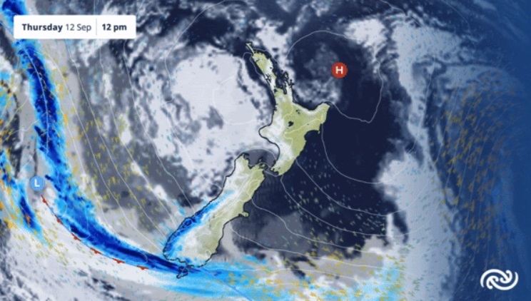
Wet weather is likely to arrive across parts of Central from Thursday. IMAGE: MetService
However, the finer details were still all to play for so advised people to keep an eye on the forecasts and any severe weather warnings.
“The best advice is to stay up to date with the forecast, [and] while the strongest winds are likely to be in the Canterbury High Country, it's always good to have a look around the garden and see what would get moved by strong winds. Although snow and cold temperatures are not unusual at this time of year, staying ahead of any severe weather, especially when it comes to stock or driving through the high country will always be beneficial.”
Recent daytime temperatures had provided more spring-like conditions, but unsettled weather patterns were not unusual for early spring.
John said the temperatures had been above average for this time of year, with 15 degrees Celsius being the average maximum temperature for Alexandra in September.
He said last year the temperature in Alexandra also hit 21C on September 9.
“The strong winds go hand in hand with the warm temperatures we have been seeing, the so-called Foehn effect, with the winds losing their moisture on the west of the southern alps and warming as they descend to the east.”
As the weather patterns fluctuate, one thing is for certain: “These next few days and leading into next week are going to be a reminder that we can't put the winter woollies away quite yet. We are on the move towards warmer temperatures but, as you know, a swing in our wind direction can still bring some colder temperatures.”
John said tonight’s overnight low for Alexandra was likely to be -2C leading to a cold and frosty morning.
Keep up to date with Weather and Roads via The Central App.


